
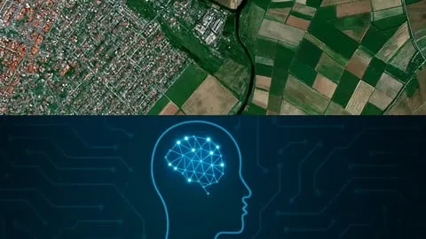
Geospatial AI: Deep Learning for Satellite Imagery
Affiliate link — we may earn a commission. Learn more
Master Satellite Imagery Analysis with Geospatial AI: Deep Learning for Satellite Imagery
Looking for a comprehensive and free geospatial AI course to upgrade your data science skills? Geospatial AI: Deep Learning for Satellite Imagery, taught by Senior Assist Prof Azad Rasul, is a professional-grade Udemy course designed to help you learn geospatial AI online. Updated July 2024, this training provides a deep dive into the intersection of artificial intelligence and earth observation, enabling students to extract actionable insights from complex satellite datasets. By mastering the fusion of deep learning and Geographic Information Systems (GIS), learners can achieve professional certification and gain practical skills in environmental monitoring and urban planning.
What You'll Learn
- Preprocess massive satellite imagery datasets for AI applications using Python and Google Earth Engine (GEE).
- Build and train high-performance Convolutional Neural Networks (CNNs) specifically optimized for geospatial tasks.
- Master the use of Sentinel-2 imagery to conduct precise crop health classification and land cover analysis.
- Implement advanced deep learning architectures to solve real-world challenges like plant counting and deforestation monitoring.
- Analyze global weather patterns and emulation using cutting-edge tools like FourCastNet.
- Evaluate AI model performance using rigorous metrics and hyperparameter tuning to ensure high accuracy.
- Apply zonal statistics and geospatial indices to quantify environmental changes across diverse landscapes.
- Compare the effectiveness of deep learning models against traditional machine learning algorithms like Random Forest.
Course Details
- Instructor: Senior Assist Prof Azad Rasul
- Rating: 3.5 stars (105,030+ reviews)
- Level: Beginner to Intermediate
- Language: English
- Enrolled students: 105,030
- Certificate: Yes, upon completion
- Includes: Lifetime access, mobile-friendly content, and a comprehensive capstone project
What This Course Covers
Python and AI Foundations for Geospatial Data
- Introduction to Python libraries essential for geospatial analysis
- Fundamentals of Artificial Intelligence and Machine Learning in the context of earth observation
- Setting up development environments in Google Colab for seamless GPU acceleration
- Understanding the structure of multi-spectral satellite imagery and raster data formats
Satellite Imagery Preprocessing with GEE
- Leveraging Google Earth Engine for large-scale satellite data acquisition
- Cleaning and normalizing Sentinel-2 imagery for deep learning compatibility
- Calculating critical geospatial indices to highlight specific environmental features
- Performing zonal statistics to aggregate data over specific geographic areas
Deep Learning Architectures for Earth Observation
- Designing Convolutional Neural Networks (CNNs) for spatial feature extraction
- Implementing image segmentation and classification for land cover mapping
- Utilizing TensorFlow and PyTorch to build scalable geospatial AI models
- Training models to recognize patterns in satellite imagery for plant counting and crop analysis
Advanced Geospatial AI Applications
- Developing models for real-world crop health monitoring and agricultural yield optimization
- Implementing FourCastNet for global weather emulation and climate forecasting
- Applying deep learning to monitor deforestation and urban expansion trends
- Analyzing the trade-offs between traditional Random Forest classifiers and modern CNNs
Model Optimization and Validation
- Implementing cross-validation techniques to prevent overfitting in geospatial models
- Conducting hyperparameter tuning to maximize model precision and recall
- Using confusion matrices and F1-scores to evaluate land cover classification accuracy
- Optimizing model inference speeds for processing large-scale satellite tiles
Capstone Project: Land Cover Classification
- Integrating the full pipeline from data acquisition to final model deployment
- Building a portfolio-ready land cover classification model from scratch
- Preprocessing raw satellite data for a specific geographic region of interest
- Validating the final AI model against ground-truth geospatial data
Who Should Take This Course
- Beginner Data Scientists who want to specialize in AI for earth observation and satellite imagery analysis.
- GIS Professionals seeking to modernize their workflows by integrating deep learning into traditional geospatial analysis.
- Environmental Researchers who need to apply CNNs to study climate change, deforestation, or agricultural patterns.
- Students and Hobbyists with basic Python knowledge who are curious about the intersection of AI and geography.
- Agricultural Analysts looking to implement automated crop health monitoring and plant counting systems.
Prerequisites
- Basic Python Knowledge: Familiarity with Python syntax and basic data structures is recommended.
- Introductory ML Concepts: A foundational understanding of machine learning is helpful but not strictly required.
- No prior GIS experience needed: This course is beginner-friendly and covers the necessary geospatial concepts from the ground up.
Why Enroll in This Course
This course offers an exceptional value proposition by bridging the gap between theoretical deep learning and practical geospatial application. In a market where satellite data is becoming increasingly critical for sustainability and urban planning, mastering these tools provides a significant competitive advantage. For a limited time, learners can access this high-level training via a free coupon, allowing them to enroll at 100% off. Given the sensitivity of these limited-time offers, now is the ideal moment to secure access to this comprehensive curriculum. Unlike generic AI courses, this program focuses specifically on the unique challenges of geospatial data, such as multi-spectral bands and coordinate reference systems.
Course Highlights
- Hands-On Project Focus: Includes a comprehensive capstone project to build a professional portfolio.
- Industry-Standard Toolset: Training covers Google Earth Engine, TensorFlow, PyTorch, and Google Colab.
- Practical Application: Focuses on real-world use cases like deforestation and crop health.
- Self-Paced Learning: On-demand video content allows learners to progress at their own speed.
- Comprehensive Certification: Earn a certificate upon completion to validate your geospatial AI expertise.
- Large Community: Join over 100,000 students who have explored the potential of satellite AI.
Frequently Asked Questions
Q: Is this course really free? A: Yes, this course is available for free when you use a valid limited-time coupon code. Once you enroll using the 100% off offer, you gain full access to all the course materials and the certificate of completion.
Q: What will I learn in this geospatial AI course? A: You will learn how to preprocess Sentinel-2 satellite imagery using Python and Google Earth Engine, design and train Convolutional Neural Networks (CNNs), and apply these models to tasks like land cover classification and weather emulation. The course covers everything from basic AI foundations to an advanced capstone project.
Q: Do I get a certificate after completing this course? A: Yes, upon successful completion of all modules and requirements, you will receive a certificate from Udemy. This certificate can be added to your LinkedIn profile or resume to demonstrate your skills in deep learning and satellite imagery analysis.
Q: Is this course suitable for beginners? A: Absolutely. While basic Python knowledge is recommended, the course is designed to take you from the fundamentals of AI to advanced geospatial applications. It is ideal for anyone starting their journey in data science or GIS who wants to learn deep learning.
Q: How long do I have to enroll for free? A: Free coupons for Udemy courses are typically available for a very limited time or for a specific number of redemptions. It is highly recommended to enroll as soon as possible to ensure you secure the 100% discount before the offer expires.
Final Thoughts
Geospatial AI: Deep Learning for Satellite Imagery is an essential resource for anyone looking to master the intersection of AI and earth observation. Whether you are a GIS professional or an aspiring data scientist, this course provides the technical framework needed to turn raw satellite data into meaningful environmental insights. Start your learning journey today and unlock the power of deep learning for a more sustainable planet.
Affiliate link — we may earn a commission
Affiliate link — we may earn a commission. Learn more